
Route 3
For the printable PDF of this walk please click HERE
The route is highlighted on the map below. Measured using the tool at https://wtp2.appspot.com/wheresthepath.htm, this route is approximately 2.1 km (1.3 miles) with 22 m (72 ft) elevation (the cumulative height climbed). None of it is particularly steep.
To extend this walk you can incorporate other parts of the footpath network. For example, you can continue straight on at point 3. The footpath continues to the end of the field, goes through the hedge and then turns right up the edge of the next field. Alternatively, when you join the road at point 6 you can turn right and then follow a track to your left some distance further up the road. See the overall walks sketch map, or an OS map, for how far you can continue these extensions.
1. Turn up Stephenwath Lane and walk up the hill. As the road bends, the verge on the right disappears and the verge on the left gets much wider. There is a footpath marker at a gap in the hedge at this point. At the time of writing (October 2020) it was lying in the hedge but pointing in the right direction.


This is where the footpath leaves the road.
2. Walk along the edge of the field, perpendicular to the road. Continue along here with the hedge on your left, until there’s a gap in the hedge shortly after a tree in the hedge. The gap isn’t obvious as you’re walking along, but there is a marker on a post.


Go through this gap in the hedge and walk down the edge of the left-hand field.
3. Turn left through the gap in the hedge and walk straight ahead, down hill, along the edge of the field with the hedge on your right. Continue to the gate at the bottom of the field.
4. Go through the kissing gate. Continue straight ahead, bearing slightly to the right, across the field to the bridge.
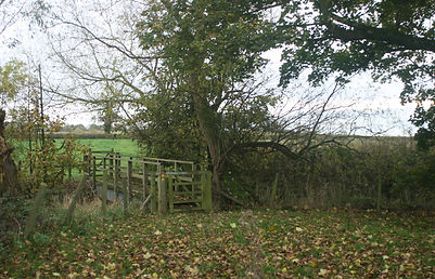
The bridge over Bugthorpe Beck.
5. Cross the bridge. Continue walking straight ahead along the edge of the field with the hedge on your right, until you get to the end of the field.
6. Go through the kissing gate in the corner of the field. Here you join the road. Turn left and walk back to the village.

There aren't spectacular views on this walk but there are pleasures to be found at a smaller scale.


Route 3 Map
For a printable pdf of the map, click here.

